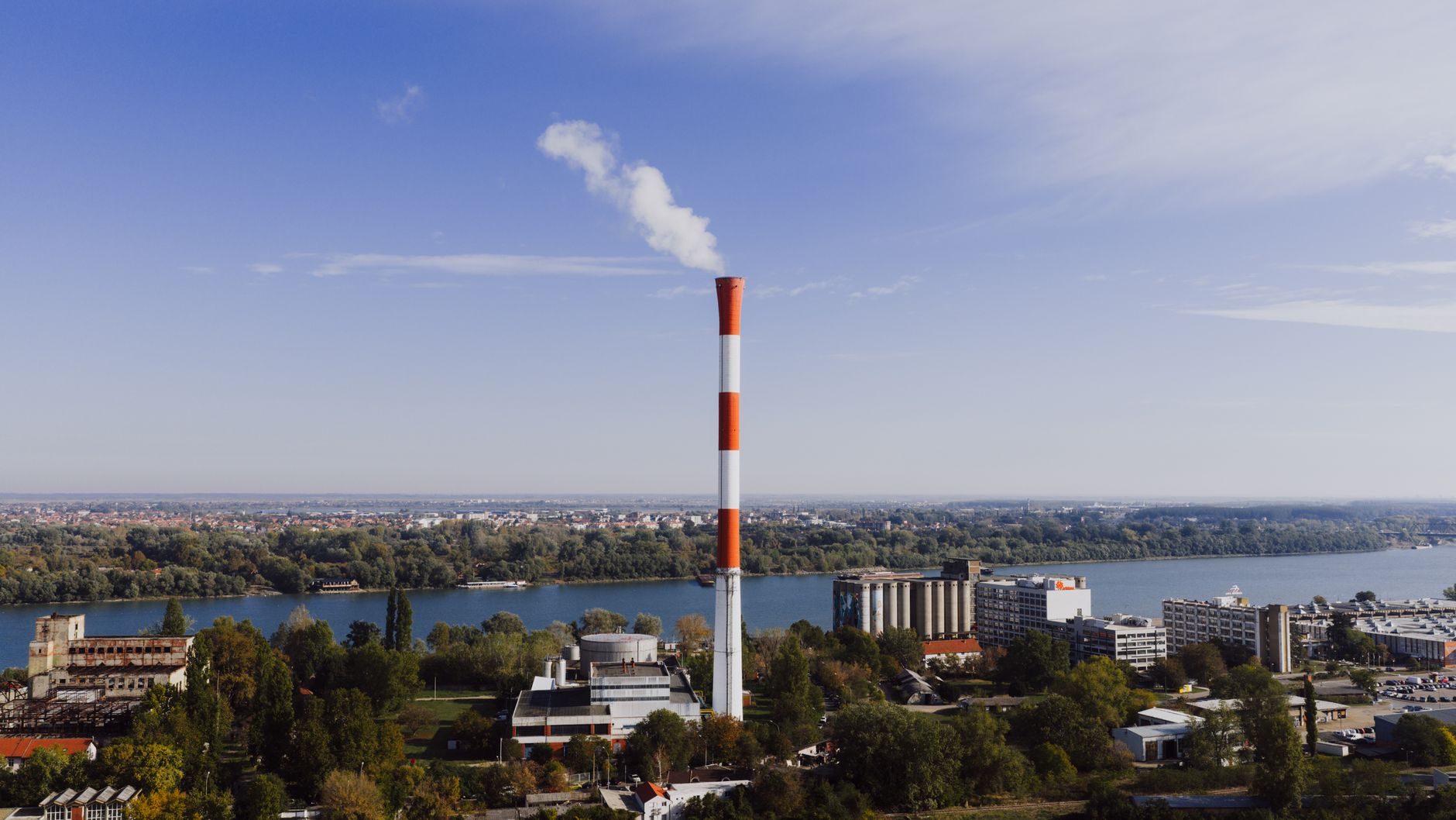
The Dholera Activation Area is the roughly 22.5 sq km plug-and-play phase-1 zone inside Town Planning Scheme 2 of Dholera SIR (NICDC states 22.54 sq km), developed first as the region's demonstration core. Per DICDL, it has about 72 km of internal roads, a roughly 50 MLD water treatment plant, underground utilities with smart water meters, a recycled-water network, a 6.5 km stormwater canal and the operational ICCC command centre. It is the built proof of Dholera, though population is still to come.
The Dholera Activation Area is the roughly 22.5 sq km plug-and-play phase-1 zone inside Town Planning Scheme 2 (TP2) of Dholera SIR, developed first as the demonstration core where trunk infrastructure was built before the rest of the 920 sq km region. NICDC states the figure as 22.54 sq km. It is where the master plan stops being a drawing and becomes physical: roads, water, power, fibre and a central command centre, all in place. At roughly 4.25% of the region's developable land, the Activation Area is small relative to the whole, but it carries almost all of Dholera's real, built proof.
This page explains what the Activation Area is, why it exists, what is actually built there according to DICDL, and how to read its significance without overstating it. Every figure is labelled reported or durable, we stay neutral on developers, and we never promise appreciation.
The Dholera Activation Area is a roughly 22.5 sq km plug-and-play zone inside TP2, built first with about 72 km of roads, a roughly 50 MLD water plant, underground utilities and the ICCC, serving as the region's proof-of-concept core.
What is the Dholera Activation Area?
The Activation Area is the phase-1 demonstration zone of Dholera SIR, a roughly 22.5 sq km area inside Town Planning Scheme 2, developed first so that the region could show working infrastructure rather than a plan on paper. The idea is 'plug and play': lay the trunk infrastructure, roads, water, power, fibre, drainage, so that industry and buildings can connect quickly. It is the smallest meaningful unit for understanding Dholera today, because when people point to what has actually been built in the region, they are almost always pointing here. For how it fits the broader blueprint, see our Dholera master plan guide.
Why does the Activation Area exist?
It exists to de-risk a decades-long, 920 sq km project by proving the model on a manageable footprint first. Building an entire city at once is neither feasible nor financeable, so the strategy is to fully service one compact zone, demonstrate that the smart-city systems work, and use that as the anchor from which development extends into the other town-planning schemes. This staged approach is common in large greenfield projects: create a credible core, attract the first anchors, and let success there justify the next phase. The Activation Area is therefore both an engineering exercise and a confidence-building one.
Where exactly is the Activation Area located?
The Activation Area sits inside TP Scheme 2, which is about 102 sq km (roughly 25,000 acres) and also contains the ABCD building. TP2 is part of Phase-I, which combines TP1 and TP2 across roughly 153 sq km. Placing the Activation Area within TP2 is deliberate, because TP2 also hosts the administrative and command heart of the city, so the built zone and the governance node sit together. This concentration is why almost all verifiable Dholera activity, infrastructure, the command centre, the first anchors, clusters in and around TP2 rather than across the wider region.
What is actually built in the Activation Area?
According to DICDL documentation from 2024, the Activation Area has a substantial, reported-built set of infrastructure. Underground utilities carry power, ICT and fibre ducts, piped natural gas and potable water, the last with smart meters and leak detection. There is a recycled-water network and separate wastewater and effluent lines, with stormwater directed into a 6.5 km man-made canal, an engineered response to the flat, flood-prone coastal terrain. A water treatment plant of about 50 MLD plus reservoirs anchors supply. The internal road network runs about 72 km, with carriageways from 18 to 70 m wide, including pedestrian and cycle lanes and a reserved corridor for future rapid transit. Our Dholera water infrastructure guide covers the water systems in more depth.
| Element | What is built (reported, DICDL 2024) |
|---|---|
| Roads | About 72 km internal network, 18 to 70 m wide, with cycle and pedestrian lanes |
| Water supply | About 50 MLD treatment plant plus reservoirs; potable mains with smart meters and leak detection |
| Recycled water | Separate recycled-water network for non-potable use |
| Drainage | Separated wastewater and effluent lines; stormwater into a 6.5 km canal |
| Utilities | Underground power, ICT and fibre ducts, piped natural gas |
| Command | ICCC in the ABCD building, reported operational |
What is the ICCC in the Activation Area?
The Integrated Command and Control Centre (ICCC) is the smart-city brain, housed in the ABCD building in the TP2 Knowledge and IT Zone, and it is reported operational. It brings water, power, street lighting, surveillance, traffic and environmental monitoring into one control room, alongside authority offices and single-window clearance. The ICCC is the clearest evidence that the Activation Area is a genuine smart zone rather than a rendering, because it is a working control layer over real utilities. The wider smart-city story, and what remains planned, is covered in our Dholera smart city explained guide.
Why is the Activation Area called the proof zone?
Because it converts Dholera's promises into something you can inspect. The region's headline of 920 sq km is a plan; the Activation Area's 22.5 sq km is infrastructure you can drive through. It is where the master plan's ideas, buried utilities, metered water, separated drainage, a central command centre, exist as built assets. For anyone assessing whether Dholera is real, the Activation Area is the honest answer: yes, a compact core is genuinely built, and no, that does not mean the whole region is. It is the single most useful place to distinguish delivered reality from long-range vision. For the region-wide snapshot, see Dholera current status 2026.
What is NOT yet true about the Activation Area?
Several honest caveats. The infrastructure is largely built, but the Activation Area is not a populated, bustling zone; the human occupancy that would make the smart systems part of daily life is still to come. An older 2020 target of about 120,000 residents and 80,000 jobs, associated with this phase, has lapsed. Some promoted features are not officially confirmed, including a common walkable 'utility tunnel', district cooling and desalination, whose statuses are unknown. So the Activation Area is best described as infrastructure-complete in large part but population-light, a serviced canvas awaiting the anchors and residents that give a city life.
How does the Activation Area connect to the rest of Dholera?
The Activation Area is the seed from which development is meant to spread into the other town-planning schemes. Its infrastructure links to the broader trunk network and to the anchors rising nearby, and the reserved rapid-transit corridor within its roads anticipates future connectivity. As the semiconductor fab, airport and rail come online, the Activation Area is positioned to be the first zone that benefits, because it already has the utilities in place. In master-plan logic, activate a compact core, prove it, then extend, and the name 'Activation Area' captures exactly that intent.
Why should you focus on the Activation Area when evaluating Dholera?
Because it is where claims are testable. Rather than debating the whole 920 sq km, ask what is built in the Activation Area, verify it against DICDL, and you get an honest, bounded picture of Dholera's real progress. It also clarifies location questions: proximity to the Activation Area, and to the anchors clustered around TP2, is a genuine planning factor in how development is unfolding, though it is never a guarantee of any financial outcome. Focusing here keeps the assessment grounded in delivered infrastructure rather than promotional scale.
What does 'plug and play' actually mean here?
Plug and play is more than a slogan; it describes an infrastructure sequencing choice. In a conventional industrial area, a factory owner often has to arrange or wait for power lines, water mains, roads and drainage after acquiring land, which delays projects and raises cost. The plug-and-play model inverts this: the authority lays serviced trunk infrastructure first, so an incoming industry can connect to ready utilities and start building faster. In the Activation Area, that means underground power, ICT and fibre ducts, piped gas, metered potable water, recycled-water lines and graded roads are already in the ground. The promise to an anchor tenant is predictability, arrive to a serviced plot rather than a bare field. Whether every plot delivers on this fully is something a specific buyer should verify, but the design intent of the Activation Area is precisely this readiness.
How does the Activation Area handle coastal and flood risk?
The zone sits on flat, low-lying 'Bhal' coastal land beside the Gulf of Khambhat, where drainage and flooding are documented planning constraints, and roughly one-third of the region's developable land falls in the Coastal Regulation Zone. The Activation Area's engineered response is visible in its infrastructure: a 6.5 km man-made stormwater canal, separated wastewater and effluent lines that keep foul water out of the storm system, and graded road corridors. This is a case where the heavy engineering in the Activation Area is not gold-plating but necessity, because building a serviceable zone on tidal coastal terrain demands deliberate drainage design. It also explains part of why the project is costly and why the built proof is concentrated rather than spread thin.
What is the ABCD building's role in the Activation Area?
Because the ABCD building sits within TP2 alongside the Activation Area, it functions as the zone's administrative and command anchor. ABCD stands for Administrative cum Business Centre for Dholera, built on a plot of about 9 hectares to a LEED Gold design, and it houses the ICCC plus authority offices and a single-window clearance function. For an industry evaluating the Activation Area, the presence of a single point for approvals and a control centre for city services is part of the pitch: governance and monitoring are co-located with the serviced land. The building is reported structurally complete and operational, though its exact inauguration date is not documented.
How does a final-plot allotment relate to the Activation Area?
Within a sanctioned town-planning scheme, land is returned to owners as a reconfigured 'final plot' (FP) after pooling and servicing. For the Activation Area, which sits inside the sanctioned TP2, a plot's final-plot number and allotment status are meaningful, because they indicate the parcel's legitimacy and its place in the serviced grid. Proximity to the Activation Area and to anchors, along with confirmed final-plot status and non-agricultural status, are among the direction-of-value factors that planners and buyers commonly weigh, though none of these guarantees any financial outcome. Anyone evaluating a specific parcel should verify its TP scheme, final-plot number and project registration on the GUJRERA portal rather than relying on proximity claims alone.
How does the Activation Area compare to activation cores elsewhere?
Staged 'activation' cores are a familiar tool in large greenfield and corridor projects: build a compact, fully serviced nucleus, prove it, then expand. GIFT City effectively did this with its compact operational core before wider growth, and corridor nodes commonly begin with a demonstration zone. Dholera's Activation Area follows the same logic at a larger regional scale, which is why judging Dholera by its Activation Area is fair: it is meant to be the representative sample of what the full region will eventually offer. The caveat is that a successful activation core does not automatically guarantee the wider build-out will follow on schedule, as Dholera's own history of delays shows.
What should a first-time researcher check about the Activation Area?
Keep it concrete. Confirm the area figure (about 22.5 sq km, NICDC 22.54) and its location inside TP2. Verify the built infrastructure claims, roads, the roughly 50 MLD water plant, utilities, the stormwater canal and the ICCC, against DICDL rather than brochures. Distinguish what is reported built from what is promoted but unconfirmed, such as a utility tunnel or desalination. And remember that infrastructure being in place is not the same as the zone being populated or as any plot being a sound purchase. The Activation Area rewards a grounded, source-checked reading more than almost any other topic in Dholera.
The Dholera Activation Area is the region's built heart, a roughly 22.5 sq km zone where the master plan has become roads, water, utilities and a working command centre. It is the strongest evidence that Dholera is more than a plan, and also a clear reminder of how much remains to be done across the wider region. If you are studying Dholera, start here, verify each built element against DICDL, and treat the Activation Area as the honest yardstick for what 'built' actually means in this project. It is the one part of Dholera where the gap between marketing and reality is smallest, which is exactly why it deserves close attention.
Frequently asked questions
What is the Dholera Activation Area?
It is the phase-1 plug-and-play demonstration zone of Dholera SIR, about 22.5 sq km (NICDC states 22.54) inside Town Planning Scheme 2, developed first with full trunk infrastructure. At roughly 4.25% of the developable land, it is small relative to the whole region but holds almost all of Dholera's built proof.
What is built in the Dholera Activation Area?
Per DICDL 2024, it has about 72 km of internal roads, a roughly 50 MLD water treatment plant, underground power, ICT, fibre and gas utilities, potable water with smart meters and leak detection, a recycled-water network, separated wastewater lines, a 6.5 km stormwater canal, and the ICCC command centre in the ABCD building.
Where is the Activation Area located?
It sits inside Town Planning Scheme 2, which is about 102 sq km and also contains the ABCD building. TP2 is part of Phase-I, which combines TP1 and TP2 across roughly 153 sq km. Placing the built zone and the governance node together concentrates Dholera's real activity around TP2.
Why is the Activation Area important?
It is the proof zone. The region's 920 sq km is a plan, but the Activation Area's 22.5 sq km is inspectable infrastructure, roads, metered water, drainage and a working command centre. It is the honest place to judge Dholera's real progress and to separate delivered reality from long-range vision.
Is the Activation Area fully developed and populated?
Its infrastructure is largely built, but it is not yet a populated, bustling zone. An older 2020 target of about 120,000 residents and 80,000 jobs has lapsed, and some promoted features like a walkable utility tunnel, district cooling and desalination are not officially confirmed. It is infrastructure-complete in large part but population-light.
- DICDL (dholera.gujarat.gov.in)
- NICDC (nicdc.in)
- DSIRDA (dholera.gujarat.gov.in)
- Gujarat SIR Act, 2009
- Wikipedia: Dholera SIR (cross-check)
The free Dholera First-Timer’s Checklist
Fifteen things to verify before you pay a rupee, in one printable PDF. Written for buyers, not brokers.